Helgelandsbukken hike

Helgelandsbukken hike
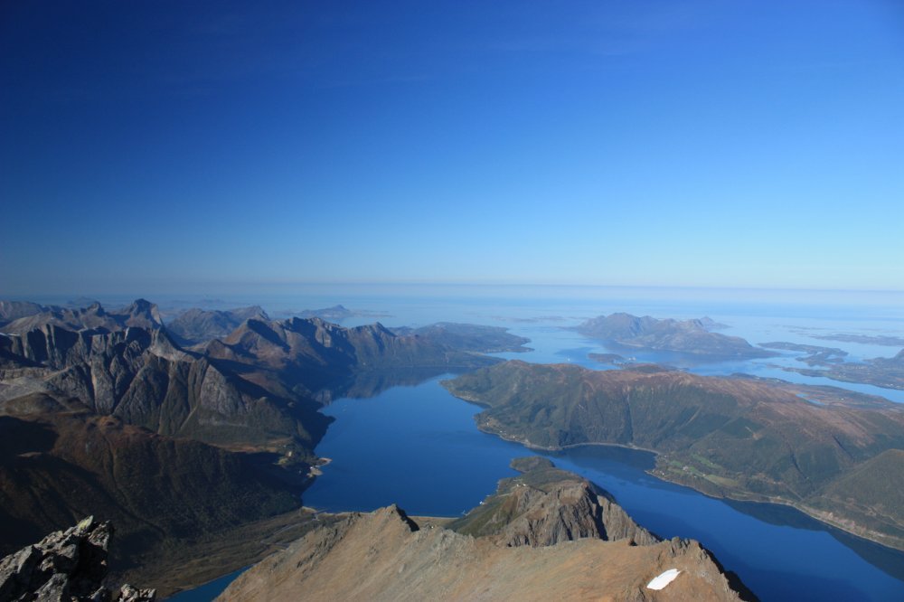
A hike to Helgelandsbukken offers you a unique opportunity to explore one of the most majestic natural wonders in Northern Norway. This natural marvel provides some of the most spectacular views of the Helgeland coastline and Svartisen, Norway’s second-largest glacier. The adventure begins with a memorable boat trip across Holandsfjorden, where you can marvel at the breathtaking sight of the crystal-clear Engabreen as it winds its way down between towering mountains. Engabreen is a remarkable part of Svartisen, and it’s fascinating to think that this is Europe’s lowest-lying glacier, with its lowest point sitting just a hundred meters above sea level.
After the boat journey, the invigorating and challenging hike to the summit of Helgelandsbukken commences. Here, you can test your mountain hiking skills while surrounded by magnificent nature. The view from the top is overwhelming, offering panoramic vistas of the Helgeland coastline and the mighty Svartisen that will leave you breathless. This is an experience that will create lifelong memories and put you in direct contact with the grandeur of nature.
Helgelandsbukken is more than just a mountain hike; it’s a journey through some of the most incredible landscapes in Northern Norway. Enjoy every step on the way up, for when you reach the summit, you’ll bear witness to nature’s magnificence and beauty at its finest. This is an experience that will enrich your understanding of the magnificent northern Norwegian wilderness.
Important!
While the maps are based on real GPS tracks, please note that their primary purpose is to provide a starting point and approximate route for the trip, rather than precise positioning. The accuracy of maps and GPS may also vary slightly.
You are always responsible for making your own judgments when venturing into the mountains, taking the current conditions into account. It’s crucial to ensure you have appropriate footwear for the conditions and that you bring an adequate supply of food and water for your journey.
It is also important to check the local weather forecast in advance.