Festvagtinden hike

Festvågtinden hike
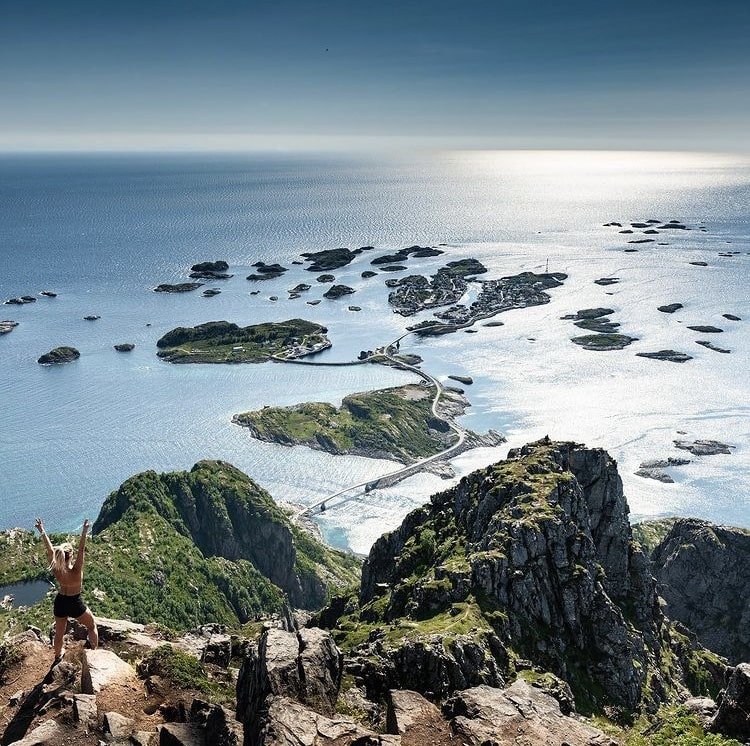
Festvågtinden hike offers a rewarding mountain hike with a steep but relatively straightforward ascent. From the very beginning of the trail, you’ll be treated to crisp mountain air and splendid views, especially on clear days. Be aware of small rolling stones along the path, as this is a highly popular hike, and many fellow hikers contribute to the trail’s wear and tear.
Upon reaching the summit of Festvågtinden, you’ll be greeted by a sheer drop down to the Vestfjorden, so exercise caution if you’re hiking with dogs or children. Festvågtinden ranks among the most sought-after hikes in the Lofoten Islands, thanks to its winning combination of accessibility, panoramic views stretching as far as the eye can see on sunny days, and a relatively manageable ascent, despite the steep sections. To tackle this hike comfortably, you should be in moderate physical condition.
The hike offers spectacular vistas at each step, with every breath of fresh mountain air invigorating your spirit. Festvågtinden stands as a testament to the raw beauty of the Lofoten landscape and the sense of accomplishment that comes from scaling one of its iconic peaks. This journey is an ideal choice for those looking to experience the best of Lofoten’s natural wonders while enjoying a moderate level of physical activity.
Important!
While the maps are based on real GPS tracks, please note that their primary purpose is to provide a starting point and approximate route for the trip, rather than precise positioning. The accuracy of maps and GPS may also vary slightly.
You are always responsible for making your own judgments when venturing into the mountains, taking the current conditions into account. It’s crucial to ensure you have appropriate footwear for the conditions and that you bring an adequate supply of food and water for your journey.
It is also important to check the local weather forecast in advance.