Trohornet hike

About the Trohornet hike
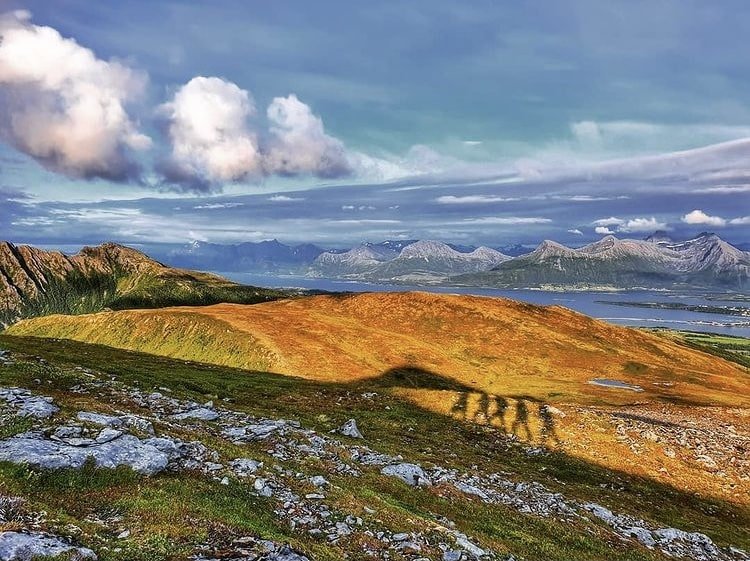
Trohornet, the second-highest peak on Engeløya, offers an incredibly beautiful and unique panoramic view of the diverse landscape. Compared to the more popular tourist destinations in Lofoten, this area remains relatively undiscovered, but an increasing number of visitors are beginning to appreciate the stunning beauty of this island.
From the start of your hike to the summit, a well-defined path guides you through a landscape that continually changes and captivates. The view from the top provides breathtaking vistas of long stretches of beaches, Vestfjorden, neighboring islands, and nearby peaks. On a clear day, you can spot Lundøya, Hamarøy, Hatten, Bogen, and Nordskot from the summit. Many consider Trohornet to offer one of the most magnificent views of one of the most beautiful islands in Northern Norway.
Throughout your hike, it’s not uncommon to spot eagles soaring above, enhancing your connection with the untamed and pristine nature of this area. Exploring Trohornet isn’t just about reaching a peak; it’s a journey through a landscape that paints a vivid picture of the rugged and diverse beauty that makes Engeløya an extraordinary place to visit. Whether you’re a seasoned hiker or a casual adventurer, Trohornet promises an unforgettable experience in the heart of Northern Norway.
Important!
While the maps are based on real GPS tracks, please note that their primary purpose is to provide a starting point and approximate route for the trip, rather than precise positioning. The accuracy of maps and GPS may also vary slightly.
You are always responsible for making your own judgments when venturing into the mountains, taking the current conditions into account. It’s crucial to ensure you have appropriate footwear for the conditions and that you bring an adequate supply of food and water for your journey.
It is also important to check the local weather forecast in advance.